- Shop our Range ▼
-
How Can We Help You?
Give Us A Call 0800 633 257
Or get us to call you...
Note: Our shop is open Monday to Friday 8:00am to 6:00pm, Saturday 8:00am to 5:00pm and Sunday 10:00am to 4:00pm (closed public holidays).
- Fast Shipping with CourierPost 95% orders shipped same day*
- Full Warranty We'll refund, repair or replace your item*
- No Worries Returns Submit a request, receive our return label & ship it back
- Lowest Price Guarantee Find a lower price, we'll match it or we can do better!
- Massive Range 21,000+ products in stock ready to ship!
- Details
-
Details
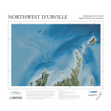
In May 2015 a joint mapping initiative between Marlborough District Council and NIWA was undertaken using NIWA's high resolution multibeam echo-sounder to reveal the shape and depth of the seafloor off Rangitoto ki te Tonga/D'Urville Island. This survey acquired close to one hundred square kilometres of multibeam bathymetry consisting of over 200 million soundings, is located within the wider Cook Strait region, and shaped by dynamic climatic, oceanographic and tectonic processes. Published in 2015, the poster is approximately 42 cm x 60 cm.
Products You Recently Viewed
-
Northwest D'Urville Poster
 ONLY $29.99
Ships Apr 1 - Apr 11
-
Black Magic 6 Pocket Lure Wrap
 Why pay $89.99ONLY $79.99SAVE $10.00!
In Stock

