- Shop our Range ▼
-
How Can We Help You?
Give Us A Call 0800 633 257
Or get us to call you...
Note: Our shop is open Monday to Friday 8:00am to 6:00pm, Saturday 8:00am to 5:00pm and Sunday 10:00am to 4:00pm (closed public holidays).
- Fast Shipping with CourierPost 95% orders shipped same day*
- Full Warranty We'll refund, repair or replace your item*
- No Worries Returns Submit a request, receive our return label & ship it back
- Lowest Price Guarantee Find a lower price, we'll match it or we can do better!
- Massive Range 21,000+ products in stock ready to ship!
- Details
-
Details
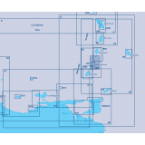
This Imray-Iolaire waterproof chart of the Grenadine Islands in the Caribbean Sea covers the area from Bequia to Carriacou with large-scale insets of Hillsborough Bay, Clifton Harbor, Charlestown Bay, and the Tobago Cays. The chart is printed in color and uses official surveys and notes based on local knowledge.
Features:- Printed in color on treated, water-resistant paper
- Folded for efficient storage
- Includes protective plastic sleeve
Specifications:- Length: 34.5 in (87.63 cm)
- Width: 25 in (63.5 cm)
- Height: 0.1 in (0.25 cm)
- Dimensions: 25' x 35 1/2' (640 x 900 cm)
- Weight: 0.3 lb (0.25 cm)
- UPC Code: 9781846232091
- HTS Code: 4905.99.0000
Products You Recently Viewed
-
Imray Grenadines Bequia to Carriacou Chart
 ONLY $94.99
Ships Mar 17 - Apr 11


